Most Hawkesbury residents know the Hawkesbury River, but few realise the vast river system that feeds it stretches from the Southern Highlands to the Blue Mountains, and from the outskirts of Canberra to north of Newcastle.
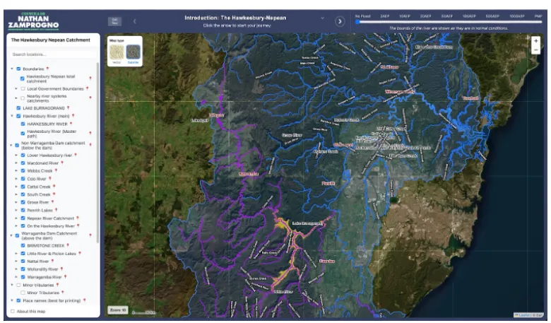
Now Hawkesbury City Councillor and teacher Nathan Zamprogno has created an interactive online map that brings the entire Hawkesbury-Nepean catchment to life, allowing residents, students and anyone with an interest in geography, flooding or the environment to explore one of Australia's most significant river systems.
Mr Zamprogno said the project grew from two lifelong interests – teaching and maps.
"There are times when my role as a teacher and being a councillor overlap in a joyful way," he said.
"Recently I've been teaching my HSC Computing class about data visualisation. It prompted me to complete a project I've been working on as an example for my students."
His interest in the Hawkesbury-Nepean system deepened during five years serving on the Hawkesbury River County Council, where he came to appreciate just how extensive and interconnected the catchment really is.
"Our river stretches nearly down to Canberra, west past Lithgow, and north of Newcastle," he said.
The interactive website maps an extraordinary network comprising 35 named rivers, 179 creeks and more than 40 dams, lakes, lagoons, swamps and bays spread across the catchment. It also shows the catchment boundary, major tributaries and flood information in a format that is both educational and easy to explore.
According to Mr Zamprogno, the project began several years ago when he was searching for a map showing the entire Hawkesbury-Nepean river system.
Unable to find one that met his needs, he created his own using publicly available geospatial data. The latest version transforms that earlier work into an interactive desktop website and incorporates dynamic flood overlays based on the 2024 Hawkesbury-Nepean Flood Study, making it a valuable educational resource as well as a practical planning tool.
The Hawkesbury-Nepean catchment covers approximately 21,400 to 22,000 square kilometres, making it one of New South Wales' largest coastal catchments. More than 70 per cent of the catchment is mountainous terrain, with water flowing through major tributaries including the Grose, Colo, Coxs, Wollondilly, Warragamba, Macdonald and Nepean rivers before reaching the Hawkesbury River and eventually Broken Bay.
The system is also central to understanding why flooding in the Hawkesbury Valley can be so severe.
Unlike many river valleys, the Hawkesbury-Nepean narrows as it approaches the coast, creating a natural bottleneck that can cause floodwaters to back up and rise rapidly during major rain events. The NSW State Emergency Service describes the valley as one of Australia's highest flood-risk areas, with communities from Wallacia through Richmond and Windsor to Brooklyn vulnerable during major floods.
Mr Zamprogno hopes the website will help students, teachers and residents better understand the river system that shapes life across much of Greater Sydney.
He said the project was designed primarily as an educational resource but was also intended to encourage curiosity about the region's remarkable geography.
The interactive map is best viewed on a desktop computer rather than a mobile phone.
Residents can explore the Hawkesbury-Nepean catchment at:
https://councillorzamprogno.info/hawkesbury_nepean (Councillor Nathan Zamprogno)