A single number could have profound consequences for the future of development across large parts of the Hawkesbury.
That number is 46.6 metres Australian Height Datum (AHD).
Australian Height Datum, or AHD, is Australia's national system for measuring elevation. Put simply, it measures how high land sits above mean sea level. A property with a ground level of 46.6 metres AHD is approximately 46.6 metres above sea level, not under 46.6 metres of water.
Under Hawkesbury City Council's revised flood planning framework for Redbank Creek North Richmond, the 46.6-metre flood planning level has become the benchmark for assessing development applications in flood-prone areas. While intended to improve community safety and resilience, the policy is expected to significantly influence where and how future development can occur.
The implications extend far beyond any new homes.
For many landowners, the policy could affect the ability to construct sheds, garages, outbuildings, rural infrastructure and other improvements that have traditionally been regarded as normal expectations of property ownership.
Some residents believe the practical effect of the policy is that substantial areas of the Hawkesbury floodplain will become increasingly difficult to develop, regardless of the existing use of the land.
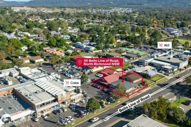
For North Richmond, where land below the vicinity of Colo High School, including the existing shopping precinct, falls below 46.6 m AHD, the new planning benchmark impact will be profound. Similar issues are likely to arise across many flood-prone communities throughout the Hawkesbury Valley.
Previous planning benchmark raises questions
Flood advice Council provided in a letter dated June 2026 to a North Richmond property owner has prompted residents to question how the new planning level was determined.
For many years, property owners in North Richmond understood that the area's Probable Maximum Flood (PMF), the largest flood considered physically possible, and the flood used to define the maximum extent of flood-prone land for evacuation and emergency planning, was approximately 30.6 metres AHD.
However, Council's flood advice now identifies an adopted Flood Planning Level of 46.6 metres AHD for the property concerned.
The advice does not state that 46.6 metres AHD is the PMF, nor does it explain how the figure was calculated. It also does not explain the relationship, if any, between the previously understood PMF level and the newly adopted planning level.
That has prompted property owners to seek further clarification from Council.
A Shift in Planning Philosophy
The revised flood planning level reflects Council's approach to managing one of Australia's most flood-prone river systems.
Rather than focusing solely on historical development patterns, the framework places greater emphasis on limiting future exposure to flood risk.
Supporters argue this approach is necessary to reduce future disaster losses, improve public safety and ensure new development is better able to withstand major flood events.
Critics, however, argue the policy represents one of the most significant changes to property rights in the district for decades.
Many landowners say they purchased their properties with a reasonable expectation they would be able to make improvements over time. They fear those expectations may now be substantially reduced.
Residents are also asking what the planning changes may mean for:
- future property values;
- redevelopment opportunities;
- business investment;
- financing and lending; and
- insurance affordability.
Impact on Hawkesbury insurance premiums
While planning controls do not automatically determine insurance premiums, insurers consider a range of flood risk information when assessing premiums and coverage. Planning restrictions can therefore become one of several factors influencing long-term perceptions of risk.
The Hawkesbury has already experienced rising insurance costs following recent major flood events, leaving many residents concerned that further planning restrictions may compound those pressures.
Calls for Greater Clarity
Community members are now seeking clearer information from Council about exactly how the 46.6-metre planning level will operate in practice.
Among the questions being asked are:
- What types of development will still be permitted below the planning level?
- Which exemptions, if any, will apply?
- How many existing properties are affected?
- How was the 46.6-metre planning level calculated?
- How does it relate to the Probable Maximum Flood?
- What options remain for owners wishing to improve their properties?
- How will the policy affect established commercial centres?
These are practical questions for thousands of Hawkesbury residents and businesses whose properties lie within the floodplain.
As the practical effects of the 46.6-metre planning level become clearer through future development applications, it is likely to remain one of the most significant planning issues facing the Hawkesbury.
Editor's Note: The Hawkesbury Gazette has written to Hawkesbury City Council seeking clarification of how the 46.6-metre Flood Planning Level was determined, how it relates to previous flood planning information, including the Probable Maximum Flood, and how it will be applied to existing residential, commercial and rural properties. The Gazette has also asked what forms of development may continue to be permitted below the planning level. Any response received from Council will be published.