Hawkesbury City Council voted at its May meeting to remove Hawkesbury LGA from participation in the NSW Rural Boundary Clearing Code following concerns raised about vegetation loss and impacts on koala habitat in the region.
The motion was introduced without notice by Councillor Wheeler during discussion attached to an update report on koala vegetation mapping across the Hawkesbury.
Cr Wheeler argued the Code had contributed to significant vegetation clearing in the Bilpin and Kurrajong area and claimed stronger protections were needed to prevent further habitat loss.
“We have seen a lot of clearing particularly around Bilpin and Kurrajong Heights of land using the Rural Boundary Clearing Code...habitat that should never have been touched ... and [the Code] has largely facilitated increased development,” Cr Wheeler told the Council meeting.
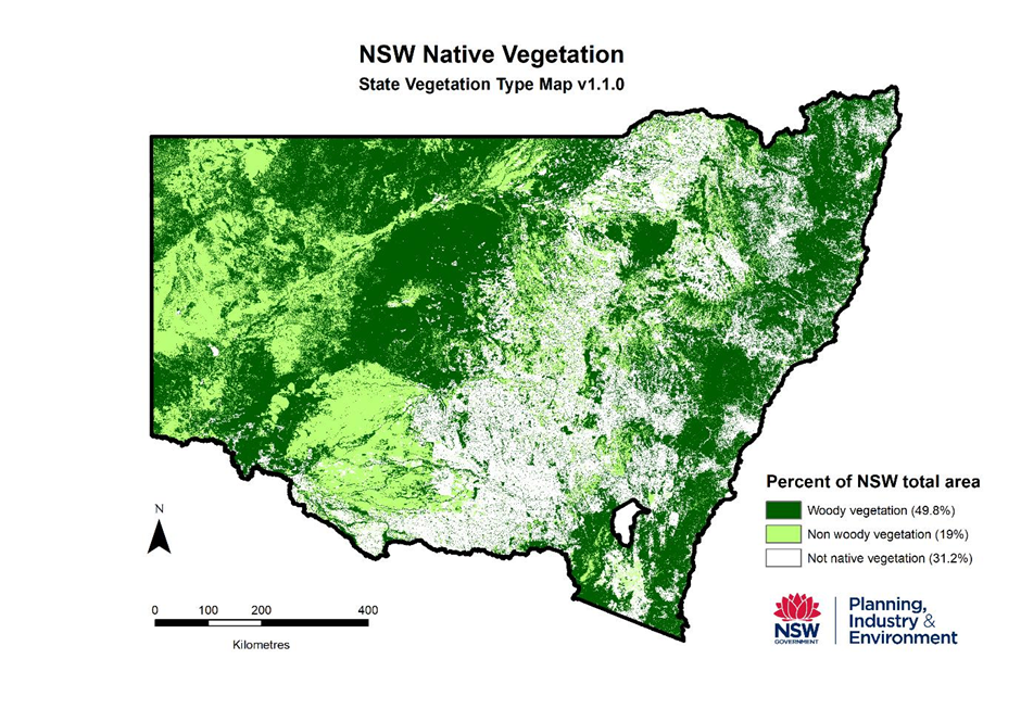
The Councillor also argued the Code was designed for different landscape conditions and was unsuitable for the Hawkesbury’s heavily forested topography.
The Code was developed for grassland "not the Hawkesbury landscape,” adding that Bilpin Rural Fire Brigade opposed the Code.
Cr Wheeler further stated that no other metropolitan council area had chosen to participate in the scheme.
During debate on the motion, several councillors expressed surprise that the matter had been brought forward without notice and sought further information regarding the implications of withdrawing from the Code.
Councillors Veigel and Creed voted against the motion, stating they did not believe sufficient information had been provided to make a fully informed decision.
Council also received an update regarding fine-scale koala habitat mapping being undertaken across the Hawkesbury.
Council Administration said further work was continuing on the mapping project, including assessment of additional sites and exploration of ways the information could potentially be made publicly available in the future.
The mapping program is being undertaken during spring and partly relies on citizen reporting and community observations of koalas.
RURAL BOUNDARY CLEARING CODE EXPLAINER
Community concern over the devastation of over 80% of the Greater Blue Mountains National Park and the subsequent death of millions of native fauna and flora, much of which was caused by escaped RFS backburn fires lit to try to contain the Gospers Mountain wildfire, created a push by residents of impacted areas to improve protection of the built and natural environment from this type of disaster.
The Rural Boundary Clearing Code was championed by former South Coast MP Andrew Constance Member for Bega whose house burnt down in the Black Summer fires. Bega Shire shares similar charactistics to Hawkesbury Local Government Area with both shaped by steep ridgelines, deeply incised valleys, sandstone or erosion-prone terrain, heavily forested slopes and fragile biodiverse areas. Both Local Government Areas have a large bushland interface with urban areas and suffer compound natural disasters of fire and flood.
The NSW Rural Boundary Clearing Code allows eligible rural landholders to clear vegetation within up to 25 metres of property boundaries for bushfire mitigation purposes without requiring they lodge a request for development approval with their local council. Instead they can lodge an application using the Rural Boundary Clearing Code Tool and receive a receipt informing them of where they have permission to clear or not. The receipt acts as the development consent.
The Code is a tool produced by the NSW Rural Fire Service in collaboration with agencies including the NSW National Parks and Wildlife Service and the NSW Environment Department.
The Code was introduced as part of broader bushfire resilience reforms across NSW. It is generally considered less relevant to open grassland areas, where landholders typically do not require permission to slash grass and low scrub on their own properties. Debate has instead focused on its use in densely vegetated landscapes containing significant native habitat and biodiversity corridors and whether clearing inside boundaries fences for 25 metres offered any increased protection to wildlife escaping fire.
Applies mainly to rural land
The Code generally applies to land in rural zones such as RU1 through to RU6 It does not automatically apply every where and some council areas or environmentally sensitive land may be excluded. Council areas that sit within the Sydney Basin planning framework, who are not entirely a regional rural Local Government Area are generally excluded from the Code.
Allows clearing within 25 metres of boundaries
Eligible landholders may remove, destroy, prune or clear vegetation within 25 metres of a property boundary on their own land. The clearing is intended primarily for firebreaks, asset protection and bushfire mitigation.
It is not a “free-for-all”
The Code contains restrictions and exclusions. Clearing cannot simply occur anywhere. Sensitive vegetation, threatened ecological communities, riparian areas, and some mapped environmentally significant land remain protected.
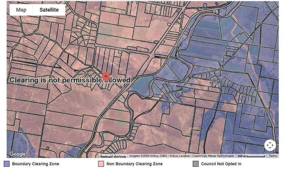
Landholders are expected to check mapping, use the NSW Rural Fire Service Boundary Clearing Tool and comply with conditions under the Code.
Native vegetation laws still apply
The Code interacts with broader NSW native vegetation laws under the Local Land Services Act 2013, the Biodiversity Conservation Act 2016, and the Land Management (Native Vegetation) Code 2018.
Even where clearing is allowed under the Boundary Clearing Code animal cruelty laws, threatened species protections and some environmental restrictions
may still apply.
Why it is controversial
Supporters argue the Code improves bushfire preparedness, reduces red tape and helps rural landholders protect lives and property.
Critics, including some environmental groups and scientists, argue it may increase habitat fragmentation, reduce wildlife corridors, weaken biodiversity protections, and allow cumulative vegetation loss without enough oversight because there is no public oversite.
Clearing can occur without public notification as consent is obtained by a receipt generated by using the Code.
Important practical issue
One of the biggest points of confusion for landholders is that land zoning, vegetation mapping, biodiversity overlays, and local council rules can all interact differently. That means clearing allowed under one framework may still require approvals under another law or planning instrument.
Useful NSW Government tools
The NSW Rural Fire Service provides a boundary clearing tool for checking eligibility:
NSW RFS Boundary Clearing Tool
The NSW Government also provides a Native Vegetation Regulatory Map:
NSW Native Vegetation Regulatory Map